6,037 results
- Books
The making of intelligence / Ken Richardson.
Richardson, Ken.Date: 1999- Books
Intoxicating minds : how drugs work / Ciaran Regan.
Regan, Ciaran.Date: [2001], ©2001- Books
- Online
The works of Cornelius Tacitus; by Arthur Murphy, Esq. With an essay on the life and genius of Tacitus; Notes, Supplements, And Maps. In four volumes. ...
Tacitus, Cornelius.Date: 1794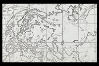
- Archives and manuscripts
- Online
Rhesus working maps and some data'.
Date: c.1965-1979Reference: PP/AEM/E.55Part of: Mourant, Arthur Ernest (1904-1994)- Books
Fayûm towns and their papyri / by Bernard P. Grenfell, Arthur S. Hunt, and David G. Hogarth, with a chapter by Grafton Milne. Maps illustrations, and four collotype plates.
Grenfell, Bernard P. (Bernard Pyne), 1869-1926.Date: 1900- Archives and manuscripts
- Online
Sketch Map of Cricthon Royal
Date: c.1940Reference: DGH1/3/11/5/4Part of: Records of Crichton Royal Hospital- Archives and manuscripts
- Online
Indian region maps'
Date: c.1965-1979Reference: PP/AEM/E.50Part of: Mourant, Arthur Ernest (1904-1994)- Books
Recent and existing commerce : with statistical supplement. Maps showing trade-areas, and tabulated list of places important in business or trade / by John Yeats. Assisted by several scientific gentlemen.
Yeats, John.Date: [1887]- Archives and manuscripts
- Online
Crichton Royal Estate Plan - Scavenging Boundaries
Date: c.1941Reference: DGH1/3/11/5/2Part of: Records of Crichton Royal Hospital- Archives and manuscripts
- Online
Block Plans of Crichton Royal Hospital Site
Date: October 1935Reference: DGH1/3/11/5/3Part of: Records of Crichton Royal Hospital
- Archives and manuscripts
- Online
Crichton Royal Estate Site Plan
Date: 1913Reference: DGH1/3/11/5/1Part of: Records of Crichton Royal Hospital- Archives and manuscripts
Site Plan - Lockerbie Fatal Accident Inquiry
Date: 1990Reference: DGH1/3/11/5/5Part of: Records of Crichton Royal Hospital- Archives and manuscripts
- Online
'Data for Rh + MN maps'. Contents of folder so inscribed.
Date: c.1965-1979Reference: PP/AEM/E.53Part of: Mourant, Arthur Ernest (1904-1994)- Archives and manuscripts
- Online
SE Asia and Island maps, some copies and extracts of tables incl. Drego data.'
Date: c.1965-1979Reference: PP/AEM/E.47Part of: Mourant, Arthur Ernest (1904-1994)- Archives and manuscripts
- Online
Photocopied maps of New Guinea with manuscript additions.
Date: c.1965-1979Reference: PP/AEM/E.51Part of: Mourant, Arthur Ernest (1904-1994)- Archives and manuscripts
- Online
Photocopied maps of America with manuscript additions and annotation
Date: c.1965-1979Reference: PP/AEM/E.45Part of: Mourant, Arthur Ernest (1904-1994)- Archives and manuscripts
- Online
Data relating to Iceland, includes tables, maps, diagrams etc.
Date: c.1973Reference: PP/AEM/E.33Part of: Mourant, Arthur Ernest (1904-1994)- Archives and manuscripts
- Online
Photocopied maps of the Pacific Islands with manuscript additions.
Date: c.1965-1979Reference: PP/AEM/E.52Part of: Mourant, Arthur Ernest (1904-1994)- Archives and manuscripts
- Online
Photocopied maps of Asia with manuscript additions and annotation.
Date: c.1965-1979Reference: PP/AEM/E.48Part of: Mourant, Arthur Ernest (1904-1994)- Archives and manuscripts
- Online
Gene maps of Africa. Photocopies, some with manuscript addition and annotation.
Date: c.1965-1976Reference: PP/AEM/E.36Part of: Mourant, Arthur Ernest (1904-1994)- Archives and manuscripts
- Online
Gene maps of North Europe. Photocopies with manuscript additions and annotation.
Date: c.1973Reference: PP/AEM/E.31Part of: Mourant, Arthur Ernest (1904-1994)- Archives and manuscripts
Letters from Robert Cameron Galton
Date: Jan 1865 - Feb 1865Reference: GALTON/2/10/2/7Part of: Galton Papers- Books
- Online
England delineated; or, a geographical description of every county in England and Wales: with a concise account of its most important products, natural and artificial. For the Use of Young Persons. With Outline Maps of all the Counties.
Aikin, John, 1747-1822.Date: M.DCC.XCV. [1795]- Books
- Online
The life of John, Duke of Marlborough, Prince of the Roman Empire; Illustrated with Maps, Plans of Battles, Sieges, and Medals, And a great Number of Original Letters and Papers Never before Published. By Thomas Lediard, Gent. ...
Lediard, Thomas, 1685-1743.Date: MDCCXXXVI. [1736]- Books
- Online
England delineated; or, a geographical description of every county in England and Wales: with a concise account of its most important products, natural and artificial. For the Use of Young Persons. With Outline Maps of all the Counties.
Aikin, John, 1747-1822.Date: 1800