691 results
- Books
Tides : a scientific history / David Edgar Cartwright.
Cartwright, David Edgar, 1926-Date: 1999- Books
- Online
Le petit Neptune françois: or, the French coasting pilot. Being a particular description of the Bays, Roads, Rocks, Sands, Land-Marks, Depths of Water, Bearings, and Distances from Place to Place; the Setting and Flowing of the Tides, on the coast of France. with Tables of the Latitude, Longitude, and Tides. Translated from the Petit flambeau de la mer of Du Bocage. With large improvements from the great Neptune françois, Bellin, Belidor, &c. In which The Courses and Distances are ascertained, from the Astronomical Observations of the Royal Academy of Sciences at Paris. Illustrated with Seventy Views of the different Appearances of Land, and Thirty New Charts. Drawn from the Large Map of France taken by Triangles by M. Cassini de Thury; the Neptune Francois; the Charts of Bellins, Michelot, and Bremond; and all the particular Surveys of the several Parts of the Coast of France. Engraved by Thomas Jefferys, Geographer to His Royal Highness the Prince of Wales.
Du Bocage, Georges Boissaye, 1626-1696.Date: 1761- Books
- Online
Essays and observations on the following subjects. Viz. On trade. - Husbandry of flax. -Raising Banks against Tides and Floods. -Hops. Directions for making Roads. Instructions for making Syder. Observations on the Linen Manufactury. -on Dressing Flax. - on brewing. Published by a Society of Gentlemen in Dublin.
Royal Dublin Society.Date: M,DCC,XL. [1740]- Books
- Online
A description of the Western Islands of Scotland. Containing a full account of their situation, extent, soils, product, harbours, Bays, Tides, Anchoring Places, and Fisheries. The Ancient and Modern Government, Religion and Customs of the Inhabitants, particularly of their Druids, Heathen Temples, Monasteries, Churches, Chappels, Antiquities, Monuments, Forts, Caves, and other Curiosities of Art and Nature. Of their Admirable and Expeditious way of Curing most Diseases by Simples of their own Product. A Particular Account of the Second Sight, or Faculty of foreseeing things to come, by way of Vision, so common among them. A Brief Hint of Methods to Improve Trade in that Country, both by Sea and Land. With a new map of the whole, describing the Harbours, Anchoring Places, and dangerous Rocks, for the benefit of Sailers. To which is added a Brief Description of the Isles of Orkney, and Schetland. To which is added a brief description of the Isles of Orkney, and Schetland. By M. Martin, gent.
Martin, Martin, -1719.Date: 1703- Books
- Online
The modern navigator's compleat tutor: or, a treatise of the whole art of navigation in its theory and practice. Containing I. Domestick or Coasting Navigation, Sundry Notes of the Moon's Motions, Calender, Tides, &c. II. Theoretical Navigation, by various Methods, viz. Geometrical, Logarithmetical, Tabular, and by the Pen only (without Tables or Instruments.) Together with Practical Astronomy, the Description, Construction, and Use of the Plain and Mercator's Charts, and other Nautical Instruments, &c. III. Practical Navigation; the Application of the Theory to Practice, in keeping a Sea-Journal, the working a Day's Log at Sea, in all Cases whatever (with Rational Corrections:) Illustrated with full, proper, and practical Examples of the same. The whole more amply and plainly demonstrated, than in any Treatise of this kind extant. To which are added, All Necessary Tables Nautical and Astronomical, for the Mariner's Practice by Inspection. Also an Appendix, Touching pleasant and critical Questions in Navigation; with divers other things both Curious and Useful in this Art. Part I. By Joshua Kelly, Mariner, and Teacher of the Mathematicks.
Kelly, Joshua.Date: MDCCXXXIII. [1733]-34- Books
- Online
The modern navigator's compleat tutor: or, a treatise of the whole art of navigation in its theory and practice, curiosity and utility. Containing I. Domestick or Coasting Navigation, Sundry Notes of the Moon's Motions, Calender, Tides, &c. II. Theoretical Navigation, by Various Methods, viz. Geometrical, Logarithmetical, Instrumental, Tabular, and by the Pen only (without Tables or Instruments.) Together with Practical Astronomy, the Description, Construction, and Use of the Plain and Mercator's Charts, and other Nautical Instruments, &c. III. Practical Navigation, The Application of the Theory to Practice; in keeping a Sea-Journal, the working a Day's Log at Sea, in all Cases of Winds and Weather, making or short'ning Sail, Trying, Hulling, &c. And, the manner of making allowance for all known Impediments whatsoever (with Rational Corrections;) Illustrated with full, proper and practical Examples of the same. The whole more amply and plainly demonstrated, than in any Treatise of this kind extant. To which are added, all necessary tables, Nautical and Astronomical, for the Mariner's Practice, by Inspection. Also an appendix, Touching Pleasant and Critical Questions in Navigation; with divers other things both Curious and Useful in this Art. By Joshua Kelly, Mariner, and Teacher of the Mathematicks.
Kelly, Joshua.Date: MDCCXXIV. [1724]- Books
- Online
Nautical descriptions of the coasts of Ireland, adapted to the several charts in the maritim survey of Ireland. Containing a particular account of the Tides, Rocks, Shoals, Channels, Anchoring-Places, and Harbours, along these coasts: with suitable sailing-directions interspersed. To which is prefixed, the principal observations and measurements on which the survey was grounded. By Murdoch Mackenzie, sen.
McKenzie, Murdoch, active 1710.Date: 1798- Books
- Online
Directions for navigating the Gulf and River of St. Laurence, with a particular account of the bays, roads, Rocks, Sands, Land-Marks, Depths of Water, Latitudes, Bearings, and Distances from Place to Place; the Setting and Flowing of the Tides, &c. Founded on accurate observations and experiments, made by the officers of his Majesty's Fleet. By order of Charles Saunders, Esq; Vice-Admiral of the Blue, and Commander in Chief of the British naval forces in th expedition against Quebec, in 1759. Published by command of the Right Hon. the Lords Commissioners of the Admiralty.
Date: M.DCC.LX. [1760]- Books
- Online
A description of the maritime parts of France, containing a particular account of all the fortified towns, forts, harbours, bays, and rivers, with their Tides, Currents, Soundings, Shoals, &c. Also of all Manufactures, and Articles of Commerce, and of the most remarkable Invasions, Sieges, and Sea-Fights, which have happened on or near that Coast. Illustrated with charts of the Sea-Coast, and Plans of all the Fortified Places on it. Collected from the best Authorities. Engraved by Tho. Jefferys, Geographer to his Majesty. To which are prefixed, A Glossary, and Plans of the several Parts of Fortification, on two Plates, to explain the Terms made Use of in the Work.
Jefferys, Thomas, -1771.Date: MDCCLXI. [1761]- Books
- Online
A compleat system of general geography: explaining the nature and properties of the earth; Viz. It's Figure, Magnitude, Motions, Situation, Contents, and Division into Land and Water, Mountains, Woods, Desarts, Lakes, Rivers, &c. With particular Accounts of the different Appearances of the Heavens in different Countries; the Seasons of the Year over all the Globe; the Tides of the Sea; Bays, Capes, Islands, Rocks, Sand-Banks, and Shelves. The State of the Atmosphere; the Nature of Exhalations; Winds, Storms, Tornados, &c. The Origin of Springs, Mineral-Waters, Burning Mountains, Mines, &c. The Uses and Making of Maps, Globes, and Sea-Charts. The Foundations of Dialling; the Art of Measuring Heights and Distances; the Art of Ship-Building, Navigation, and the Ways of Finding the Longitude at Sea. Originally written in Latin by Bernhard Varenius, M.D. Since improved and illustrated by Sir Isaac Newton and Dr Jurin; and now translated into English; with additional Notes, Copper-Plates, an Alphabetical Index, and other Improvements. Particularly useful to Students in the Universities; Travellers, Sailors, and all those who desire to be acquainted with Mixed Mathematics, Geography, Astronomy, and Navigation. By Mr Dugdale. The whole revised and corrected by Peter Shaw, M.D. The second edition, with large additions. In two volumes.
Varenius, Bernhardus, 1622-1650.Date: 1734- Books
- Online
A compleat system of general geography: explaining the nature and properties of the earth; viz. It's Figure, Magnitude, Motions, Situation, Contents, and Division into Land and Water, Mountains, Woods, Desarts, Lakes, Rivers, &c. With particular Accounts of the different Appearances of the Heavens in different Countries; the Seasons of the Year over all the Globe; the Tides of the Sea; Bays, Capes, Islands, Rocks, Sand Banks, and Shelves. The State of the Atmosphere; the Nature of Exhalations; Winds, Storms, Tornados, &c. The Origin of Springs, Mineral-Waters, Burning Mountains, Mines, &c. The Uses and Making of Maps, Globes, and Sea-Charts. The Foundations of Dialling; the Art of Measuring Heights and Distances; the Art of Ship-Building, Navigation, and the Ways of Finding the Longitude at Sea. Originally written in Latin by Bernhard Varenius, M.D. since improved and illustrated by Sir Isaac Newton and Dr Jurin; and now translated into English; with additional notes, copper-plates, an Alphabetical Index, and other Improvements. Particularly useful to Students in the Universities; Travellers, Sailors, and all those who desire to be acquainted with Mixed Mathematics, Geography, Astronomy, and Navigation. By Mr Dugdale. The whole revised and corrected by Peter Shaw, M.D. In two volumes.
Varenius, Bernhardus, 1622-1650.Date: 1733- Books
- Online
A compleat system of general geography: explaining the nature and properties of the earth; Viz. It's Figure, Magnitude, Motions, Situation, Contents, and Division into Land and Water, Mountains, Woods, Desarts, Lakes, Rivers, &c. With particular Accounts of the different Appearances of the Heavens in different Countries; the Seasons of the Year over all the Globe; the Tides of the Sea; Bays, Capes, Islands, Rocks, Sand-Banks, and Shelves. The State of the Atmosphere; the Nature of Exhalations; Winds, Storms, Tornados, &c. The Origin of Springs Mineral-Waters, Burning Mountains, Mines, &c. The Uses and Making of Maps, Globes, and Sea-Charts. The Foundations of Dialling; the Art of Measuring Heights and Distances; the Art of Ship-Building, Navigation, and the Ways of Finding the Longitude at Sea. Originally written in Latin by Bernhard Varenius, M.D. Since improved and illustrated by Sir Isaac Newton and Dr Jurin; and now translated into English; with additional Notes, Copper-Plates, an Alphabetical Index, and other Improvements. Particularly useful to Students in the Universities; Travellers, Sailors, and all those who desire to be acquainted with Mixed Mathematics, Geography, Astronomy, and Navigation. By Mr. Dugdale. The whole revised and corrected by Peter Shaw, M.D. The third edition, with large additions. In two volumes.
Varenius, Bernhardus, 1622-1650.Date: 1736- Books
- Online
The english pilot, describing the sea-coasts, capes, headlands, streights, soundings, Sands, Shoals, Rocks and Dangers. The bays, roads, harbours, and ports in the oriental navigation, Shewing the Property and Nature of the Winds and Monsoons in those Seas; with the Courses and Distances from one Place to another: The Setting of the Tides and Currents; The Ebbing and Flowing of the Sea. Also, A New table of Variations; and a Correct table of Longitudes and Latitudes; With many other things necessary to be known. Containing several large Draughts of Ports, Islands, and Descriptions; collected from the Practice and Experience of divers able and expert navigators of our Own and Foreign Nations. Divided into three parts. The first, Shewing The Nature and Properties of the Winds and Monsoons in the Navigation from England, to the East-Indies, and the whole oriental ocean, and thereby how to shape a Course from one Port to another, according to the Time of the Year in those Seas. The second, Containing Necessary instructions for Sailing between England, and the East-Indies, in the Spring and Autumn. The third, Describing The Sea-Coasts, Capes, Headlands, Streights, Soundings, Sands, Shoals, Rocks and Dangers. The Islands, Bays, Roads, Harbours and Ports, from Cape Bona-Esperance, to all Parts of the oriental ocean, being very much Corrected and Augmented with several Additions, not before Publish'd.
Date: M,DCC,LV. [1755]- Books
- Online
Directions for navigating the Gulf and river of St. Lawrence. With a particular account of the bays, roads, Rocks, Sands, Land-Marks, Depths of Water, Latitudes, Bearings, and Distances from Place to Place; the Setting and Flowing of the Tides, &c. Founded on accurate observations and experiments made by the officers of His Majesty's fleet. By order of Charles Saunders, Esq; Vice-Admiral of the Blue, and Commander in Chief of the British naval forces in the expedition against Quebec, in 1759. Published by command of the Right Hon. the Lords Commissioners of the Admiralty.
Date: M.DCC.LXI. [1761]- Books
- Online
A rejoinder to Mr. Dobb's reply to Captain Middleton; In which is expos'd, Both his wilful and real Ignorance of Tides; &c. his Jesuitical Prevarications, Evasions, Falsities, and false Reasoning; his avoiding taking Notice of Facts, formerly detected and charged upon him as Inventions of his or his Witnesses; the Character of the latter, and the present Views of the former, which gave rise to the present Dispute. In a Word, An unparalelled Disingenuity, and (to make use of a Verodobbsical Flower of Rhetoric) a Glaring Impudence, are set in a fair Light. By Christopher Middleton, Esq.
Middleton, Christopher, -1770.Date: [1745]- Books
- Online
The seaman's sure guide, or, navigator's pocket remembrancer: wherein are given such plain instructions in every useful branch of navigation, as will in a short time form the complete mariner. Among the variety of essential articles contained in this Work are, The Method of Working Tides, or finding High Water at any Place. - Geometry, and the Doctrine of Plain Triangles. - To make Log-Lines, and correct Distances given by Log when the Glass, Line, or both are faulty. - The various Sailings, with Amplitudes and Azimuths. - To find the Apparent and True Altitudes of the Sun, Moon, and Stars. - The different Methods of finding the Latitude. How to find the Apparent Time at Sea, to Regulate the Watch. - The new Method of finding the Longitude by Sun and Moon, or Moon and a fixed Star. - To rectify Courses; with Rulés for correcting the Dead Reckoning, by an Observation in all Cases. - Exercising Examples of Days Works. - A complete log of a ship's voyage, with Instructions for writing a Journal from the Log Book, &c. &c. Upon an Improved Plan, For the Use of Schools. By J. Bettesworth, Master of the Naval Academy, Chelsea, and late Mathematical Master of the Maritime School.
Bettesworth, John.Date: M.DCC.LXXXIII. [1783]- Books
- Online
The ladies astronomy and chronology, in four parts: Viz. I. A short and easy Explanation of the real Nature and Causes of the Phanomena of the Celestial Lights. The Occasion of the Eclipses, and Reason of the Tides, the Terrestrial and Celestial Spheres. And the Machine called the Assimilo, explained. Beginning at Page 13. II. The Ptolemaic System explained; the Reasons of Days and Nights; their Increase, and Decrease; the different Seasons, viz. Summer and Winter, Heat and Cold, the Moon's Increase and Decrease; the Solar and Lunar Eclipses; and when they happen: All demonstrated by the Assimilo. Beginning at Page 32. III. The Copernican System explained, and all the fore-mention'd Particulars demonstrated, according to that System, by the Assimilo; and proved, though the Sun be nearer to us in Winter than in Summer, that will not Counter-Change the Seasons, as many apprehend. Beginning at Page 55. IV. The Elements of Chronology explained, viz. Kalendars, Cycles, and Periods, and how to find all the Particulars generally taken Notice of in the Almanacks: And solved the most useful Problems in Navigation, and Astronomy; and shewn how to find the Variation of the Magnetical Compass, and the Latitude by Observation: and likewise explained the System of the Planets and Comets, and demonstrated them by the Assimilo; which performs every Thing that can be done by the common artificial Globes. As well as the Demonstration of both the Ptolemaic and Copernican Systems; Beginning at Page 83. This Book was composed, and the Assimilo invented and contrived in the Year 1734. By Jasper Charlton, Officer of the Customs at Gainsborough in the County of Lincoln; And published by Authority of the King's Royal Order for Letters Patent, for the Term of Fourteen Years.
Charlton, Jasper.Date: 1735- Books
- Online
An essay on currents at sea; By which it appears, There is Reason to apprehend, that the Sea is not a Fluid in a State of Rest, except those Motions which are caused by the Impulse of Winds, and that known by the Name of Tides: And consequently, That this Earth is not of a uniform Density, according to the Supposition of Sir Isaac Newton; but that the Currents of the Gulph of Florida, also on the Coast of Brasil, and the Northern In-Draught on this Western Coast, are Currents of Circulation, kept up by different Densities in this Earth, and its Motion round its Axis. By Joseph Mead.
Mead, Joseph, 1707-1799.Date: M,DCC,LVII. [1757]- Books
- Online
A voyage from Calcutta to the Mergui archipelago, lying on the east side of the Bay of Bengal; Describing a Chain of Islands, never before surveyed, that form a Strait on that Side of the Bay, 125 Miles in Length, and from 20 to 30 Miles in Breadth; with good Mud Soundings and regular Tides throughout: which Strait lying nearly North and South, any Ship may work up against the South-West Monsoon, and so get out of the Bay of Bengal, when otherwise, she might be locked up for the Season. Also, An Account of the Islands Jan Sylan, Pulo Pinang, and the Port of Queda; the present State of Atcheen; and Directions for Sailing thence to Fort Marlbro' down the South-West Coast of Sumatra: To which are added, An Account of the Island Celebes; a Treatise on the Monsoons in India; a Proposal for making Ships and Vessels more convenient for the Accommodation of Passengers; and Thoughts on a new Mode of preserving Ship Provision: Also, An Idea of making a Map of the World on a large Scale: By Thomas Forrest, Esq. Senior Captain of the Honourable Company, Marine at Fort Marlbro' in 1770, and Author of the Voyage to New Guinea. The whole illustrated with various Maps, and Views of Land; a Print of the Author's Reception by the King of Atcheen; and a View of St. Helena from the Road. Engraved by Mr. Caldwall.
Forrest, Thomas, 1729?-1802?.Date: M.DCC.XCII. [1792]- Books
- Online
Theory of tides. Translated from the French of Monsieur de St. Pierre.
Saint-Pierre, Bernardin de, 1737-1814.Date: [1795]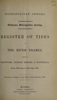
- Books
- Online
Register of tides in the River Thames : taken at Deptford, London Bridge, & Battersea, from 19th June to 19th July, 1849.
London (England). Metropolitan Commission of Sewers.Date: [1849]- Books
Changing tides of chemotherapy of malaria / L.J. Bruce-Chwatt.
Bruce-Chwatt, Leonard Jan.Date: 1964- Books
The tides of life : the endocrine glands in bodily adjustment / by R.G. Hoskins.
Hoskins, R. G. (Roy Graham), 1880-1964.Date: 1933- Books
The true theory of the tides, extracted from that admired treatise of Isaac Newton, intitled, Philosophiae naturalis principia mathematica : being a discourse presented with that book to the late King James / by Edmund Halley.
Halley, Edmond, 1656-1742.Date: 1708- Books
Telescopes, tides, and tactics : a Galilean dialogue about the Starry messenger and systems of the world / Stillman Drake.
Drake, Stillman.Date: [1983], ©1983