279 results
- Archives and manuscripts
Original Commissioner's Areas in South Wales
Date: Apr 1937-Mar 1938Reference: SA/NBT/T.8/1/2Part of: National Birthday Trust Fund- Books
Pigot and Co.'s national commercial directory : comprising a directory and classification of the merchants, bankers, professional gentlemen, manufacturers and traders in all the cities, towns, sea-ports, and prinicipal villages in the following counties, viz., Bedfordshire, Berkshire, Buckinghamshire, Cambridgeshire, Cornwall, Devonshire, Dorsetshire, Gloucestershire, Hampshire, Herefordshire, Huntingdonshire, Monmouthshire, Norfolk, Northamptonshire, Oxfordshire, Somersetshire, Suffolk, Wiltshire, and the whole of South Wales ... the whole embellished with 18 elegant county maps.
J. Pigot & Co.Date: 1830-1831- Archives and manuscripts
- Online
Minutes, correspondence and Area Organiser reports
Date: 1952-1957Reference: SA/FPA/A4/G76Part of: Family Planning Association- Archives and manuscripts
- Online
Minutes, correspondence and Area Organiser reports
Date: 1958-1960Reference: SA/FPA/A4/G77Part of: Family Planning Association- Archives and manuscripts
- Online
Minutes, correspondence and Area Organiser reports
Date: 1961-1965Reference: SA/FPA/A4/G78Part of: Family Planning Association- Archives and manuscripts
- Online
Doctors' Group
Date: 1956-1960Reference: SA/FPA/A4/G79Part of: Family Planning Association- Archives and manuscripts
- Online
Minutes and correspondence
Date: 1949-1952Reference: SA/FPA/A4/G75Part of: Family Planning Association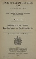
- Books
- Online
Census of England and Wales, 1911 (10 Edward 7 and 1 George 5, ch. 27.).
Great Britain. Census Office.Date: 1912-23- Books
- Online
Bowles's new medium English atlas; or, Complete set of maps of the counties of England and Wales: Divided into their respective hundreds, wapontakes, wards, rapes, lathes &c. Exhibiting the roads, rivers, cities; borough, market, and sea-port towns; principal villages and places of note; with their distances from London, and members sent to Parliament; also church-livings, seats of the nobility, and a variety of historical extracts relative to the natural produce, trade, manufactures and commerce. Compiled and laid down from the latest authorities. 1 General map of England and Wales. 2 Bedsershire 3 Berkshire 4 Buckinghamshire 5 Cambridgeshire 6 Cheshire 7 Cornwall 8 Cumberland and Wesmorland 9 Derbyshire 10 Devonshire 11 Dorsetshire 12 Durham 13 Essex 14 Goucestershire 15 Hampshire 16 Hartfordshire 17 Herefordshire 18 Huntingdonshire 19 Kent 20 Lancashire 21 Leicester and Rutland 22 Lincoln 23 Middlesex 24 Monmouthshire 25 Norfolk 26 Northamptonshire 27 Northumberland 28 Notinghamshire 29 Oxfordshire 21 Rutland (see Leicester) 30 Shropshire 31 Somersetshire 32 Staffordshire 33 Suffolk 34 Surry 35 Sussex 36 Warwickshire 8 Westmorland (see Cumberland) 37 Wiltshire 38 Worcestershire 39 Yorkshire 40 East riding, Yorkshire 41 West riding, Yorkshire 42 North riding, Yorkshire 43 North Wales 44 South Wales[.]
Bowles, Carington, 1724-1793.Date: MDCCLXXXV. [1785]- Books
- Online
The geography of England and Wales; Or, A set of maps of all the counties in England and Wales, with the great roads and principal cross-roads, and the distances from town to town. A work long wanted, and very useful for all gentlemen that travel to any part of England. All, except two, composed and done by Herman Moll, geographer. 1. The map intituled, In gratiam itinerantium curiosorum antonini Aug. Itinerarium per Britanniam tentavit Wil. Stukeley. 2. A general map of England. 3. Ogilby's roads through all the direct and principal cross-roads in England and Wales. 4. Bedfordshire. 5. Berkshire. 6. Buckinghamshire. 7. Cambridgshire. 8. Cheshire. 9. Cornwall. 10. Cumberland. 11. Derbyshire. 12. Devonshire 13. Dorsetshire 14. Durham. 15. Essex. 16. Gloucestershire. 17. Hampshire. 18. Isle of wight. 19. Herefordshire. 20. Hertfordshire. 21. Huntingdonshire. 22. Kent. 23. Lancashire. 24. Leicestershire. 25. Lincolnshire. 26. Middlesex. 27. Monmouthshire. 28. Norfolk. 29. Northamptonshire. 30. Northumberland. 31. Nottinghamshire. 32. Oxfordshire. 33. Rutlandshire. 34. Shropshire. 35. Somersetshire. 36. Staffordshire. 37. Suffolk. 38. Surrey. 39. Sussex. 40. Warwickshire. 41. Westmoreland. 42. Wiltshire. 43. Worcestershire. 44. Yorkshire. 45. -West Riding. 46. -East Riding. 47. -North Riding. 48. South Wales. 49. North Wales. 50. Denbigh and Flintshire. 51. The isles of man, Guernfey and Jersey. And, to render this work more acceptable to the curious, the margins are adorned with great variety of very remarkable antiquities.
Moll, Herman, -1732.Date: 1747- Books
- Online
A set of fifty new and correct maps of the counties of England and Wales, &c. with the great roads and principal cross-roads, &c. Shewing the computed miles from town to town. A work long wanted, and very useful for all gentlemen that travel to any part of England. All, except two, composed and done by Herman Moll, geographer. Viz. 1. The map intituled, in gratiam itinerantium curiosorum antonini Aug. itinerarium per britanniam tentavit Wil. Stukeley, 1723. 2. A general map of England. 3. Cornwall. 4. Devonshire. 5. Dorsetshire. 6. Somersetshire. 7. Wiltshire. 8. Hampshire. 9. Isle of Wight. 10. Berkshire. 11. Surry. 12. Sussex. 13. Kent. 14. Glocestershire. 15. Oxfordshire. 16. Buckinghamshire. 17. Bedfordshire. 18. Hertfordshire. 19. Middlesex. 20. Essex. 21. Suffolk. 22. Norfolk. 23. Cambridgeshire. 24. Huntingdonshire. 25. Northamptonshire. 26. Leicestershire. 27. Rutlandshire. 28. Lincolnshire. 29. Nottinghamshire. 30. Derbyshire. 31. Warwickshire. 32. Worcestershire. 33. Staffondshire. 34. Shropshire. 35. Cheshire. 36. Herefordshire. 37. South-Wales. 38. Monmouthshire. 39. North-Wales. 40. Denbigh and Flintshires. 41. Yorkshire. 42. -West Riding. 43. -East Riding. 44. -North Riding. 45. Durham. 46. Lancashire. 47. Westmoreland. 48. Cumberland. 49. Northumberland. 50. The isles of Mar, Guernsey, and Jersey. And, to render this work more acceptable to the curious, the margins of each map are adorned with great variety of very remarkable antiquities.
Moll, Herman, -1732.Date: [1739]- Books
- Online
Fifty six new and acurate maps of Great Britain, Ireland and Wales; With all the direct and cross roads exactly tracted in the maps, which are more full and exact than any extant, having all the cities, Parliament and market towns, villages, parks, hundreds, wapentacks, &c. distinguish'd. Begun by Mr. Morden: perfected, corrected and enlarg'd by Mr. Moll. The name of the maps, 1 The S. part of G. Britain. 2 The N. part of G. Britain. 3 Ireland. 4 Berkshire. 5 Bedfordshire. 6 Buckinghamshire. 7 Cambridgeshire. 8 Cheshire. 9 Cornwall 10 Cumberland. 11 Derbyshire. 12 Devonshire. 13 Dorsetshire. 14 Durham. 15 Essex. 16 Glocestershire. 17 Hampshire. 18 Isles of Wight, Jersey, Guernsey, Seilly, Sark, Alderney, Man, &c. 19 Herefordshire. 20 Hertfordshire. 21 Huntingdonshire. 22 Kent. 23 Lancashire. 24 Leicestershire. 25 Lincolnshire. 26 Middlesex. 27 Monmouthshire. 28 Norfolk. 29 Northamptonshire. 30 Northumberland. 31 Nottinghamshire. 32 Oxfordshire. 33 Rutlandshire. 34 Shropshire 35 Somersetshire 36 Surrey. 37 Sussex. 38 Staffordshire. 39 Suffolk. 40 Warwickshire. 41 Westmorland. 42 Wiltshire. 43 Worcestershire. 44 Yorkshire. Wales. 45 Anglesey.
Morden, Robert, -1703.Date: 1708
- Books
- Online
[Report 1932] / Monmouthshire County Council.
Monmouthshire (Wales). County Council.Date: 1932
- Books
- Online
[Report 1938] / Monmouthshire County Council.
Monmouthshire (Wales). County Council.Date: 1938
- Books
- Online
[Report 1936] / Monmouthshire County Council.
Monmouthshire (Wales). County Council.Date: 1936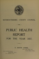
- Books
- Online
[Report 1927] / Monmouthshire County Council.
Monmouthshire (Wales). County Council.Date: 1927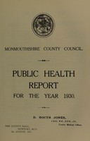
- Books
- Online
[Report 1930] / Monmouthshire County Council.
Monmouthshire (Wales). County Council.Date: 1930
- Books
- Online
[Report 1937] / Monmouthshire County Council.
Monmouthshire (Wales). County Council.Date: 1937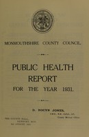
- Books
- Online
[Report 1931] / Monmouthshire County Council.
Monmouthshire (Wales). County Council.Date: 1931
- Books
- Online
[Report 1926] / Monmouthshire County Council.
Monmouthshire (Wales). County Council.Date: 1926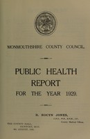
- Books
- Online
[Report 1929] / Monmouthshire County Council.
Monmouthshire (Wales). County Council.Date: 1929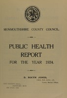
- Books
- Online
[Report 1934] / Monmouthshire County Council.
Monmouthshire (Wales). County Council.Date: 1934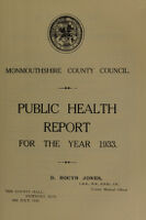
- Books
- Online
[Report 1933] / Monmouthshire County Council.
Monmouthshire (Wales). County Council.Date: 1933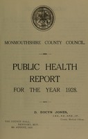
- Books
- Online
[Report 1928] / Monmouthshire County Council.
Monmouthshire (Wales). County Council.Date: 1928
- Books
- Online
[Report 1935] / Monmouthshire County Council.
Monmouthshire (Wales). County Council.Date: 1935