North and Central America and the Pacific and Atlantic Oceans: map. Engraving, ca. 1777.

Date:
[1777?]
Reference:
677708i
  • Pictures
  • Online

Available online

view North and Central America and the Pacific and Atlantic Oceans: map. Engraving, ca. 1777.

Public Domain Mark

You can use this work for any purpose without restriction under copyright law. Read more about this licence.

Credit

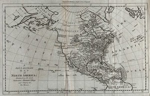
North and Central America and the Pacific and Atlantic Oceans: map. Engraving, ca. 1777. Wellcome Collection. Public Domain Mark. Source: Wellcome Collection.

Selected images from this work

View 1 image

About this work

Publication/Creation

[London] : [publisher not identified], [1777?]

Physical description

1 print : engraving ; platemark 28.9 x 44.8 cm

Lettering

A new and accurate map of North America drawn from the most authentic modern maps and charts by Thos. Bowen. Engraved for Middleton's Complete system of geography.

Reference

Wellcome Collection 677708i

Type/Technique

Languages

Where to find it

  • LocationStatusAccess
    Closed stores

Permanent link