Person
Moll, Herman, -1732
Images
Catalogue
By this person (2)
About this person (1)
- Books
- Online
Modern history or, the present state of all nations. Describing their respective situations, persons, habits, and buildings, manners, laws and customs ... plants, animals, and minerals / by Mr. Salmon ; illustrated with cuts and maps ... by Herman Moll.
Salmon, Thomas, 1679-1767.Date: 1744-1746
- Books
- Online
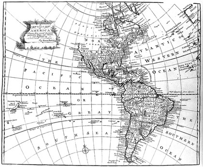
Atlas geographus: or, a compleat system of geography, ancient and modern / Containing what is most of use in Bleau, Varenius, Cellarius, Cluverius, Baudrand, Brietius, Sanson, &c. With the discoveries and improvements of the best modern authors to this time. Illustrated with about 100 new maps, done from the latest observations, by Herman Moll, geographer. And many other cuts, by the best artists.
Moll, Herman, -1732Date: 1711-1717